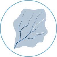
A watershed encompasses the land that contributes overland flow to a particular body of water. Water making its way downhill has no regard for jurisdictional boundaries such as county lines that were established in the late 1800s. To understand water quality and quantity, all inputs must be considered together as the most complete knowledge of where water ends up begins with where it starts. Thus, the watershed boundary is the outside edge of what is necessary to begin an evaluation of a stream, lake, or river.
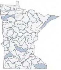
Regulations related to a common resource, like a drinking water aquifer or a lake, require coordination among the governing bodies of the various counties, townships, or cities involved. The actions of any one county to control storm water runoff could be offset by careless policies in another. With 81 major watersheds contributing to eight primary river basins, intersecting 87 counties and many more cities and townships, it makes sense to organize planning based on watersheds and to approach management and resource protection from the landscape perspective.

The One Watershed, One Plan program being developed by the Minnesota Board of Water and Soil Resources is changing the focus of water planning from a county basis to a watershed basis. Planners looking at the contributing landscape as a whole can make the most of staff expertise, protect sensitive areas, and manage their budgets to maximize beneficial outcomes. Buffers play a role in all the primary concerns of watershed planners and are a key part of watershed based plans.
Benefits of a Watershed Approach
Once planners are able to work with entire landscapes that span artificial government boundaries, they can be easier to protect. The following are some of the key benefits of a watershed approach:
| Shared resources |
A watershed approach can create shared vision for the management of waterbodies and other natural resources. Government units, non-profits, and other partners can also share their staff resources, knowledge, and available funding to increase effectiveness. |
| Addressing non-point source pollution |
A watershed approach can more effectively address nonpoint source pollution. Indirect, difficult to quantify, and often carried by the sudden washes of snow melting or rainwater, nonpoint source pollution is hard to treat. It threatens water quality and fish and wildlife habitat. Pollution compounds as it is carried along to larger streams, rivers, and, eventually, the ocean. However, because it is spread out and is not associated with any one particular location, nonpoint pollution can be addressed by equally diffuse, small-but-common treatments such as buffers and other conservation practices over the landscape. Slowing water flow, allowing sediment to drop out and natural processes to work, reduces the load that eventually dumps into a larger body of water. |
| Landscape connections |
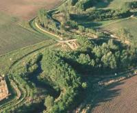
Looking at the landscape as a whole, it is easier to see how existing natural areas might be joined together with a small investment in restoration, easements, or civic engagement to form a continuous corridor or greenway. Such greenways benefit animals, plants, and water quality more than the sum of what would occur if areas of similar size were managed separately. They are also more resilient to changes in climate, changing land uses, and invasive species. These connective actions are only possible when taking a larger, big-picture view of the landscape to see where wildlife trails, erosive streams, and habitat zones are located. |
Watershed Planning
Watershed planning helps identify resource needs and set specific goals to protect and improve resources. The goals can be varied; they focus on water quality, wildlife habitat, biomass production, or a variety of other landscape benefits. Once these goals are established, the next step is to prioritize available project sites based on their potential to meet goals. Individual sites are then targeted for specific actions. What might be less intuitive but equally important is to measure the outcomes. What, exactly, have you gained from the hours of work and thousands of dollars spent? Did the actions you took have the results you expected? The benefits of some practices are easier to quantify than others.
The concept Prioritize-Target-Measure is being promoted by the Minnesota Board of Water and Soil Resources as a method to plan for and implement effective projects. To prioritize is to recognize that not all valued resources and identified issues can be addressed at the same time—some items will be addressed before others. To target is to take a closer look at priority areas and issues and identify specific cost-effective and measurable actions necessary to achieve goals and address issues. To measure is the ability to demonstrate progress towards the achievement of restoration and protection goals over time. The concept was also incorporated into a decision support framework adopted by the Red River Water Management Board and coded into an application available for free download. Designed for SWCDs, county local water planning, agency staff, and decision-makers, it simplifies the process and then documents the results.
With some substitutions, Prioritize-Target-Measure is comparable to the NRCS Nine Step Planning Process. ‘Prioritize’ is comparable to Phase I Collection and Analysis, where the steps are to determine objectives, identify problems, inventory resources, and analyze resource data. ‘Target’ is akin to Phase II Decision Support: formulate and evaluate alternatives and make decisions. Finally, ‘Measure’ is all about the Phase III Evaluation. The Nine Step Plan puts implementation of the plan in Phase III, whereas P-T-M doesn’t commit to whether this goes at the end of ‘Target’ or the beginning of ‘Measure.’
The EPA watershed planning process (pdf) has six steps: Build partnerships; Characterize the watershed; Finalize goals and identify solutions; design the implementation; implement the plan; measure progress and make adjustments. Good planning follows a similar progression, no matter what the steps are called.