Purpose
To provide direction to local governments charged with implementing the buffer law, specifically reviewing buffers in consideration of scale and requests for validation of compliance.
Statutory Reference
Minnesota Statutes §103F.48, The Buffer Law, requires buffer widths based on the classification of the waters identified on the Buffer Protection Maps, including:
(1) For all public waters, the more restrictive of:
a) a 50-foot average width, 30-foot minimum width, continuous buffer of perennially rooted vegetation; or
b) the state shoreland standards and criteria adopted by the commissioner under section 103F.211; and
(2) For public drainage systems established under chapter 103E, a 16.5-foot minimum width continuous buffer as provided in section 103E.021, subdivision 1. The buffer vegetation shall not impede future maintenance of the ditch.
Scale for Compliance Determination
Overall status of “Compliant” or “Not Compliant” is to be determined on an individual parcel basis. Each parcel would have a unique local identification number typically associated with the property tax parcel identification number.
- If a landowner owns multiple parcels adjacent to a water body, each individual parcel will undergo its own determination of compliance. Example 1 (below) shows this landowner has three parcels. Parcels A & B are compliant and Parcel C is not.
- If any riparian buffer areas are enrolled in CRP, see the CRP Exemption guidance for the appropriate accounting of the land under contract.
- If a validation of compliance is requested by a landowner, the request should reference the specific parcel(s) for which the request is being made.
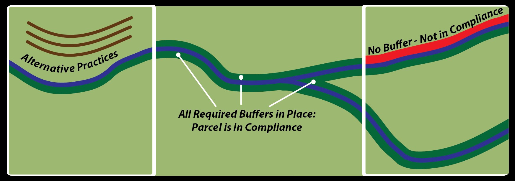
Example 1
Determination of Compliance within a Parcel:
Within a given parcel, all buffers and/or alternative practices must be compliant in order to consider the entire parcel compliant. In Example 2, all three buffers must be individually compliant for the parcel to be found compliant overall.
- Each bank of a water body defined by the DNR’s Buffer Protection Maps shall be reviewed independently to ensure the water resource is adequately protected through use of the appropriate buffer and/or alternative practices. See Example 2
- If a stream reach calls for two buffers of different widths on the same bank each area would be treated independently. See Example 3
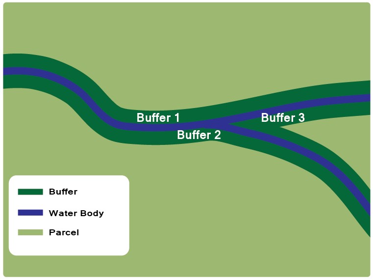
Example 2 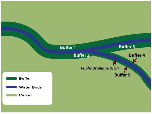
Example 3