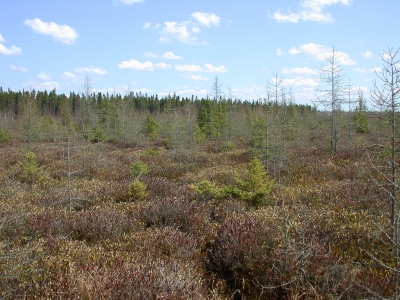
What are Peatlands and Why Do They Matter?
A peatland is a type of wetland ecosystem characterized by the natural accumulation of organic matter derived from decaying plant material (peat) under permanent water saturation. Peatlands are dominated by actively forming peat and usually contain a foot or more of accumulated peat. The most common peatland plant communities in Minnesota are bogs, which are fed mainly by rainfall, and fens, which are fed mainly by groundwater. These broad categories include also include some lowland conifer swamps and many unique landforms, including the raised bogs and patterned fens found in a number of Scientific and Natural Areas.
Peatlands store up to 30% of the world’s terrestrial carbon (C) despite occupying just 3% of the terrestrial land surface; they also represent a huge source of carbon that is at risk of being released by runaway climate change at current rates of warming. They therefore play a critical role in the global carbon cycle.
Minnesota has more peatlands – nearly 7 million acres, and more than 10% of the state's land area – than any other state outside Alaska. However, many of these lands were ditched and drained in the past for farming or other purposes. Drained peatlands lose significant amounts of carbon as they decompose due to exposure to oxygen and microbial decomposition, and they also provide opportunities to sequester carbon after restoration as peat layers regenerate.

Previous estimates indicated that up to one-sixth of Minnesota's peatlands were fully or partially drained. A more refined analysis by The Nature Conservancy (2024) indicates that approximately 846,000 acres of peatland are partially drained (within 150 meters of ditches) while another 594,000 acres are fully drained, generally for farmland, pasture, or urban development. These cultivated soils, rich in organic matter, emit an estimated 11 million metric tons of carbon dioxide and nitrous oxide per year, making them the largest source of CO2 emissions reported by the Minnesota Pollution Control Agency in the Agriculture sector.
The Minnesota Climate Action Framework (2022) identifies peatland protection as a high priority under the Natural and Working Lands goals and strategies:
Protect, restore, and manage peatlands and other wetlands - Peatlands (bogs and fens) hold some of Minnesota’s largest carbon reserves, but emit large quantities of carbon when ditched and drained. Protecting existing peatlands and other wetlands, and restoring drained, farmed or pastured peatlands and wetlands will increase carbon storage.
Funding for Peatland Restoration
As of May 2025, state and federal funds are available for peatland restoration across Minnesota.
- BWSR received state funding in 2023 to acquire easements "to restore and enhance peatlands and adjacent lands... for the purposes of climate resiliency, adaptation, carbon sequestration and related benefits." Easements are available through the RIM Reserve Program and CREP (see below).
- In 2024, Minnesota was awarded a Climate Pollution Reduction Grant from the Environmental Protection Agency, administered by the Minnesota Pollution Control Agency. The grant, now termed the Minnesota Climate-Smart Food Systems program, includes $20 million to BWSR, the Department of Natural Resources, and Tribal Nations to protect and restore peatlands originally drained for agriculture. BWSR is seeking opportunities to work with both public and private partners to identify potential restoration sites.
Permanent Easement Options for Peatland Restoration: RIM & CREP
BWSR now offers permanent easement options for peatland restorations through the RIM Wetlands and CREP programs. Learn more on the RIM Wetlands or CREP pages.
NEW: Webinar on Peatland Restoration
On January 6, 2026, BWSR staff held a webinar covering many aspects of peatland restoration, funding, and available easement programs. Watch a recording of the webinar.
Where are Peatlands Located? Check BWSR's Potentially Restorable Peatlands Mapping Tool
Peatland soils are concentrated across northern Minnesota, but extend southward across the central regions of the state. The mapping tool was developed to identify peatland soils that have been completely or partially drained and that may be suitable for restoration, to reduce carbon loss and maximize carbon sequestration. Restoration potential will depend on many factors, including current land use and ownership, available funding sources, and technical feasibility, and will require a thorough site-level evaluation. BWSR has worked closely with The Nature Conservancy and U.S. Forest Service researchers to develop this tool, and appreciates their work in developing estimates of drained and farmed peatland acreage, as well as the Histosol and Soil Organic Carbon data layers.
The mapping tool has recently been updated to include Tribal lands, DNR-managed landholdings, and School Trust Lands, along with a more refined and complete histosol layer. BWSR staff welcome comments and suggestions for further improvement. Please contact staff listed below with your ideas.
How to Use the Mapping Tool
The map will initially appear with only county boundaries and histosols (the main type of peatland soils) shown. Use the Layer List icon to add additional layers, move layers up or down, or to review descriptions of any layer. Use the Legend icon to view a legend showing the currently visible layers. Base maps can be changed using the Basemap Gallery. You can use the search window to search for an address, a county, or another mapped feature. Because of the number of layers available, you may need to focus on only a few at a time while exploring the map. The drop-down section below provides detailed descriptions of the source of each layer.
- Data Layers and References
Histosols – Histosols are defined by the Natural Resources Conservation Service as “soils that are dominantly organic … commonly called bogs, moors, or peats and mucks. A soil is classified as Histosol if it does not have permafrost and is dominated by organic soil materials."
According to the NRCS Illustrated Guide to Soil Taxonomy (2022), histosols are formed in thick accumulations of organic material from decaying plant material. The organic-dominated layers are typically at least 40 cm (~16 inches) thick, with a minimum of 12 to 18% organic carbon by weight (depending on clay content). Histosols do not exhibit the kinds of horizons common to mineral soils but rather have layers, or tiers, that vary in color, botanical origin of the organic material, amount of mixed-in mineral soil material, degree of decomposition, and other properties. Histosols generally have significantly lower bulk density and higher nutrient- and water-holding capacities than most mineral soils.
The Minnesota Wetland Inventory is a publicly available GIS database that provides information on the location and characteristics of wetlands in Minnesota. It is based on the framework for the National Wetlands Inventory (NWI). These data are used in wetland regulation and management, land use and conservation planning, environmental impact assessment, and natural resource inventories. The NWI is a planning and assessment tool, not a jurisdictional wetland determination. There are many ways to define wetlands. While the layer shown here combines all wetland types into one category, the full NWI incorporates four different wetland classifications, based on factors such as plant community, type of habitat, water regime and landscape position. Location and extent of all wetlands should be verified through site inspection before any action is taken that could affect the wetland.
Public Ditches – This layer is drawn from Minnesota's Buffer Map, developed by the Department of Natural Resources, based on the Public Waters Inventory (PWI). Additional ditches are often visible on aerial photos as linear breaks; these may be private ditches or other ditches that have been abandoned but remain on the landscape.
BWSR RIM (Reinvest in Minnesota) Reserve Easements – This layer depicts the approximate boundaries of lands protected by State of Minnesota conservation easements. Boundaries should be considered approximate and do not necessarily represent survey grade data. The objective of the RIM Reserve program is to restore marginal agricultural lands and protect environmentally sensitive areas. In cooperation with county Soil & Water Conservation Districts (SWCDs), BWSR's easement programs compensate landowners for granting conservation easements and establishing native vegetation habitat on economically marginal, flood-prone, environmentally sensitive or highly erodible lands.
BWSR Wetland Banking Easements – This layer identifies all wetland bank sites managed through the state wetland banking system and administered by BWSR. Minnesota's wetland banking program includes both private and state-sponsored wetland banks which have "credits" that are used to offset (mitigate) authorized wetland impacts. As with RIM easements, boundaries are considered approximate and do not necessarily represent survey grade data.
Cropland Data Layer (CDL) – This layer is maintained by the U.S. Department of Agriculture, National Agricultural Statistics Service. It uses satellite imagery to provide acreage estimates for major commodities. The full dataset is found on the CropScape website. The CDL is updated annually. Note that the legend for this category is simplified to include only those crops grown in Minnesota.
Government Ownership Parcels – This layer was developed and supplied by the Minnesota Department of Natural Resources. It includes lands owned or managed by federal, state, county, regional and municipal governments. State-managed land includes school trust lands and consolidated conservation "con-con" lands. Tax forfeit lands are held in title by the state but generally managed at the county level. For further details, see the DNR's "Minnesota State Land Portfolio" webpage. To identify the specific type of public ownership (e.g., State Forest, State Park, National Wildlife Refuge, etc.), it can help to use a base map with more information, such as "Navigation."
Tribal Lands - Provided by the Minnesota Department of Transportation, this layer represents the Minnesota interpretation of federally recognized tribal boundaries in the state, including areas managed by tribal governments both within and outside reservation boundaries.
Soil Organic Carbon – This layer, developed by The Nature Conservancy, shows a weighted average (g C/m2) of soil organic carbon from the USDA-NRCS gSSURGO (gridded Soil Survey Geographic) database (October 2021). It largely coincides with the Histosols layer.
Sample Searches
The document below provides examples of how to identify potentially restorable peatlands in several regions of Minnesota. In general, start by looking for histosols that do not overlap with the National Wetland Inventory and that may be in agricultural or other land uses. As noted above, these searches are only a first step: assessing the restoration potential of a site will depend on many factors, including the depth of organic matter, topography, dominant plant communities, hydrology, current land use, and landownership.
Sample Searches for Restorable Peatlands (pdf)